
Archive Record
Images
Additional Images [2]
Metadata
Catalog Number |
2018.001.152 |
Title |
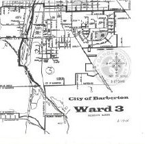
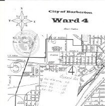
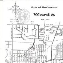
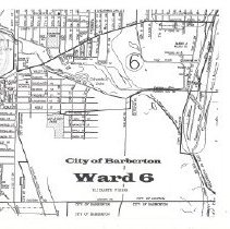
Maps of Barberton, Wards 1-6. |
Notes |
Eight pages paperclipped. Copies of originals. All pages measure 8 1/2 inches by 11 inches. Drawer M2-4. |
Scope & Content |
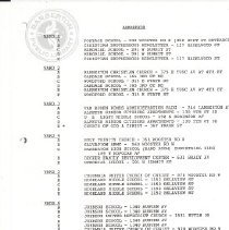
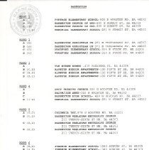
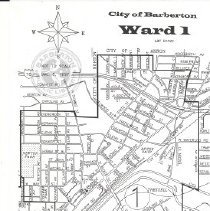
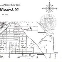
Maps showing wards 1-6 in Barberton, Ohio, including schools and churches (as polling locations). Eight paperclipped pages: A. List of Barberton Wards 1-6, separated into sections A, B, C, D, E, and F (if necessary). Lists schools and churches in each ward. Dated 10/9/92. B. List of Barberton Wards 1-6, separated into sections A, B, C, and D. Lists schools, churches, and senior apartments in each ward. Dated 2/15/2000. C. Map of Ward 1 D. Map of Ward 2 E. Map of Ward 3 F. Map of Ward 4. The center is blocked by a post-it note. G. Map of Ward 5 H. Map of Ward 6 |
Object Name |
Map |
Accession number |
2018.001 |
Search Terms |
Barberton Portage Elementary School Christian Brotherhood Newsletter Memorial Elementary School Barberton Christian Church Oakdale Elementary School Woodford Elementary School U.L. Light Middle School Church of God Church of Christ Holy Trinity Catholic Church Salvation Army Barberton High School Decker Family Development Center Columbia Church of Christ Highland Junior High School Johnson Elementary Barberton Wesleyan Methodist Church |
Subjects |
Maps Streets Roads Elections Schools Churches Apartments |