
Archive Record
Images
Metadata
Catalog Number |
2021.002.004 |
Title |
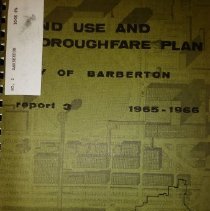
Land Use and Thoroughfare Plan |
Caption |
Land Use and Thoroughfare Plan, 1965-1966 |
Scope & Content |
A spiral-bound booklet containing the Land Use and Thoroughfare Plan created by Tri-County Regional Planning Commission, 578 West Market St., Akron, Ohio. It is "a summary of the objectives and proposals incorporated in the land use and thoroughfare plans for the development and redevelopment of the City of Barberton and the Barberton area". The plan was prepared with financial assistance from a federal grant from the Urban Renewal Administration of the Housing and Home Finance Agency. Table of Contents: Community Objectives and Goals Regional and Local Influences The Land Use Plan Thoroughfare Plan Central Area Plan Implementation List of Tables List of Maps The plan was filed with Summit County on December 6, 1966, with Roy Ruff, Recorder. An additional loose map of a revised version of the Land Use Plan was file with Summit County on April 27, 1970, with Roy Ruff, Recorder. |
Object Name |
Plan |
Accession number |
2021.002 |
People |
Alexander, A.E. Canfora, Albert Cornachione, Marine J. Cox, Kenneth Deibel, John Haring, Ophair Headley, David Krosnick, Andrew M. Lieberth, Joe Maurer, Lawrence A. McGrady, John R. McIlwain, W.W. Mori, Wade Peresta, Mike Pramuka, Albert V. Ruff, Roy Seiberling, John Tholt, Walter Thomas, Ray R. White, Curtis Zeigler, Joseph |
Search Terms |
Barberton Tri-County Regional Planning Commission |
Subjects |
Commercial districts Community beautification Housing Industrial development Industry Land Land development Land use Maps Planning, City Plans Thoroughfares Urban planning Urban redevelopment Urban renewal |